San Juan County Conservation Land Bank
Mount Grant Preserve
San Juan Island
Activities


Features


Located between Mount Dallas and Cady Mountain on San Juan Island, Mount Grant Preserve protects and provides access to 250 acres of diverse forest, woodlands, and meadows. The Preserve has been assembled through four separate acquisitions between 2000-2017 and is a joint project of the Conservation Land Bank and San Juan Preservation Trust and was also made possible through generous donations.
250
ACRED PRESERVED
Trail Description
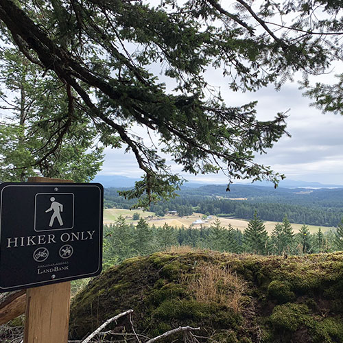
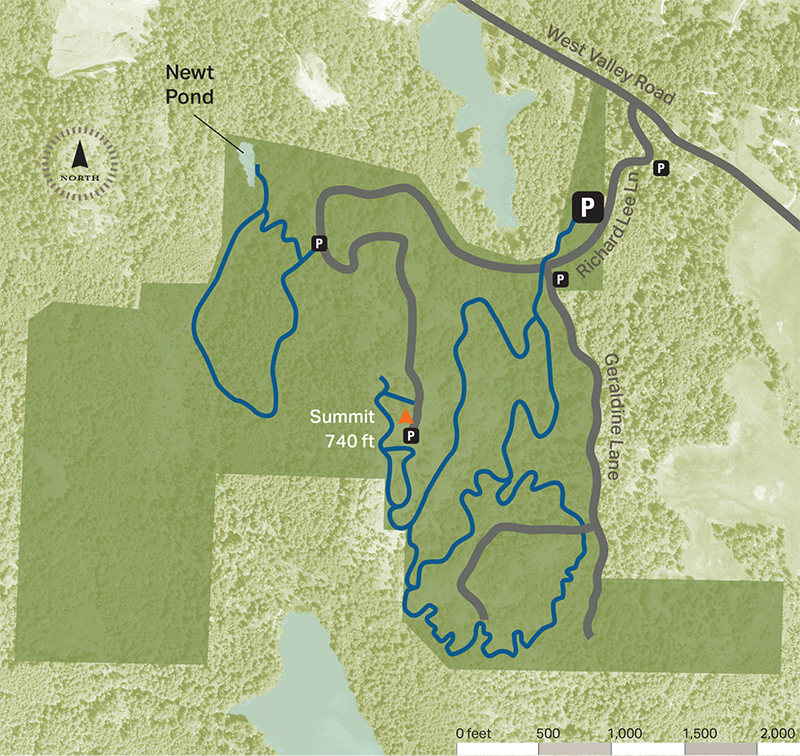
Visitors to the ridge top summit are rewarded with sweeping vistas in all directions. Trails and roadways to the summit are open daily for pedestrian and non-motorized use. Equestrian use is open on designated trails. Driving access to the summit is open (weather permitting) Wednesdays and Sundays, from 10am to 7pm (April – September) and Sundays, 10am to 4pm (October- March) for everyone to enjoy the Preserve’s expansive views, regardless of physical ability.
Preserve Map
When you visit
• Parking and entry road is on an easement. Please respect private property.
• Pedestrians, bicycles and horses remain on designated roads and trails.
• Day use only, no camping.
• No fires.
• Leash your dog and pack out waste.
• Follow leave no trace principles. Take nothing and leave nothing.
• Seasonal deer hunting—written permission required.
• Driving access to summit available (weather permitting) — April–Sept: Wed & Sun, 10am–7pm. Oct–March: Sundays, 10am–4pm
Driving Directions
From the Friday Harbor ferry landing:
Turn left onto Spring Street. At 0.2 miles, turn right onto Second Street. At 0.4 miles, continue onto Guard Street. At 1.2 miles, Guard Street becomes Beaverton Valley Road. At 4.7 miles Beaverton Valley Road becomes West Valley Road (at the intersection with Boyce Road). At 5.5 miles turn left at Richard Lee Lane. Continue for 0.2 miles, primary trailhead is located on the right.
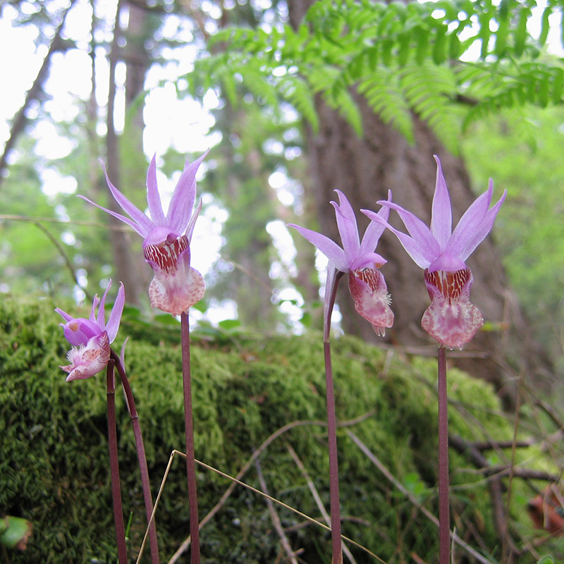
Click the links below to see what flora and fauna others are observing at this Preserve.