A Connector Trail and Parking Clarifications at Mount Grant Preserve on San Juan Island
October 16, 2023
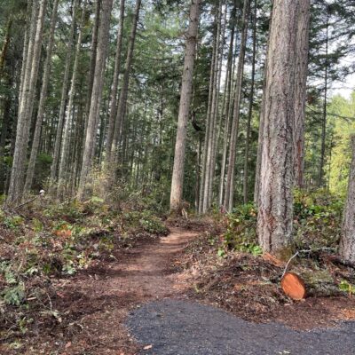
 A connector trail is under construction from the new, mid-mountain parking area to the Greywacke trailhead! A Washington Conservation Corps crew roughed in a trail over the weekend and is scheduled to complete the forested walk this week, adding another off-road option to your Mount Grant Preserve hike. If you enjoy the extra “vert” from the base, the lower parking area is indeed still available for public parking. The lower parking area is located on property belonging to the neighbors, over which the Land Bank holds an access and utility easement as well as a service area easement. Specifically, the service area easement is a special easement over adjacent private property providing non-exclusive use for “ingress, egress, utilities, parking, mailboxes, call box, storage and caretaker’s structure.” Being non-exclusive allows the neighbors to use this area as well.
Since opening, the parking area and trailhead for Mount Grant Preserve has been located at its base, on the neighbor’s property, and in use by way of the special easement. It has been the Land Bank’s intention to add a mid-mountain parking area as well. (see excerpt below, taken from the Mount Grant Preserve Stewardship and Management Plan). Timing and permits finally aligned this past August, leading to the construction of the new, mid-mountain parking area up the hill.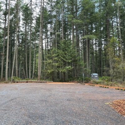
Preserve Parking and Trailheads
Three designated parking areas are envisioned for Mount Grant Preserve, referred to in this plan as base, mid-mountain, and summit. Two of the formal parking areas will have one ADA accessible parking space sited to provide easy access to trailhead and interpretive signage and restroom facilities.
The base parking area will be open to daytime public access on a daily basis. Initially this will be developed to provide parking for ten vehicles, but up to two additional spaces may be constructed if necessary.
The mid-mountain parking area is intended to be used when driving access to the summit is open, but may also be opened for daily use. Initially, mid-mountain parking will provide parking for up to eight vehicles, with the potential to add up to four parking spaces if necessary.
As for signage, the Land Bank is limited to what can be posted on private property and adhere to the legal process of obtaining permission. In the meantime, the Land Bank has been working with the County to create an updated directional sign at the junction of West Valley Road and Richard Lee Lane.