
Preserves and
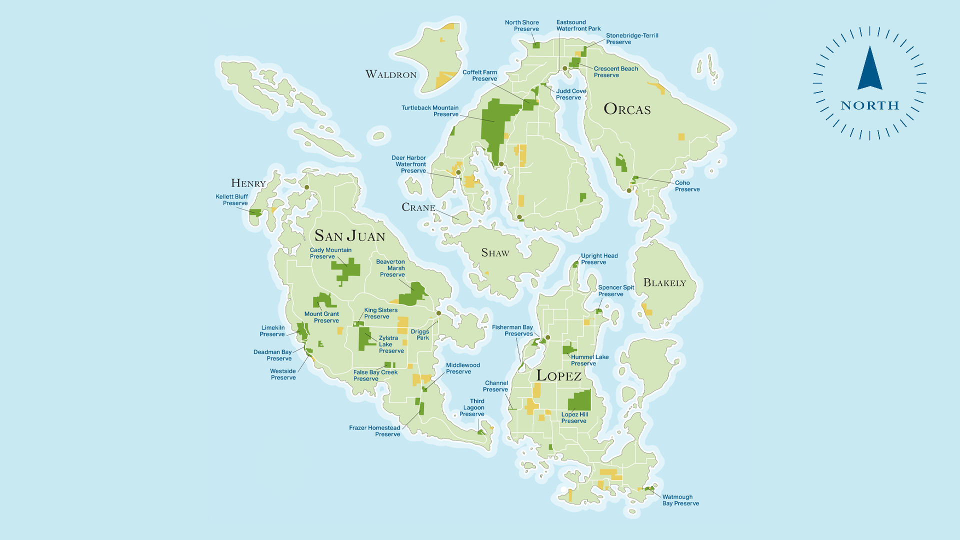
SAN JUAN ISLANDS
Conservation Easements
In this interactive map, you can navigate through your protected lands in San Juan County. Click on the pins in this map and you will be directed to the respective Island with the island information and link to the listing of protected lands. Click "Back to County Map" to get back to the main selector.
Download Map (PDF) Here

San Juan County Land Bank
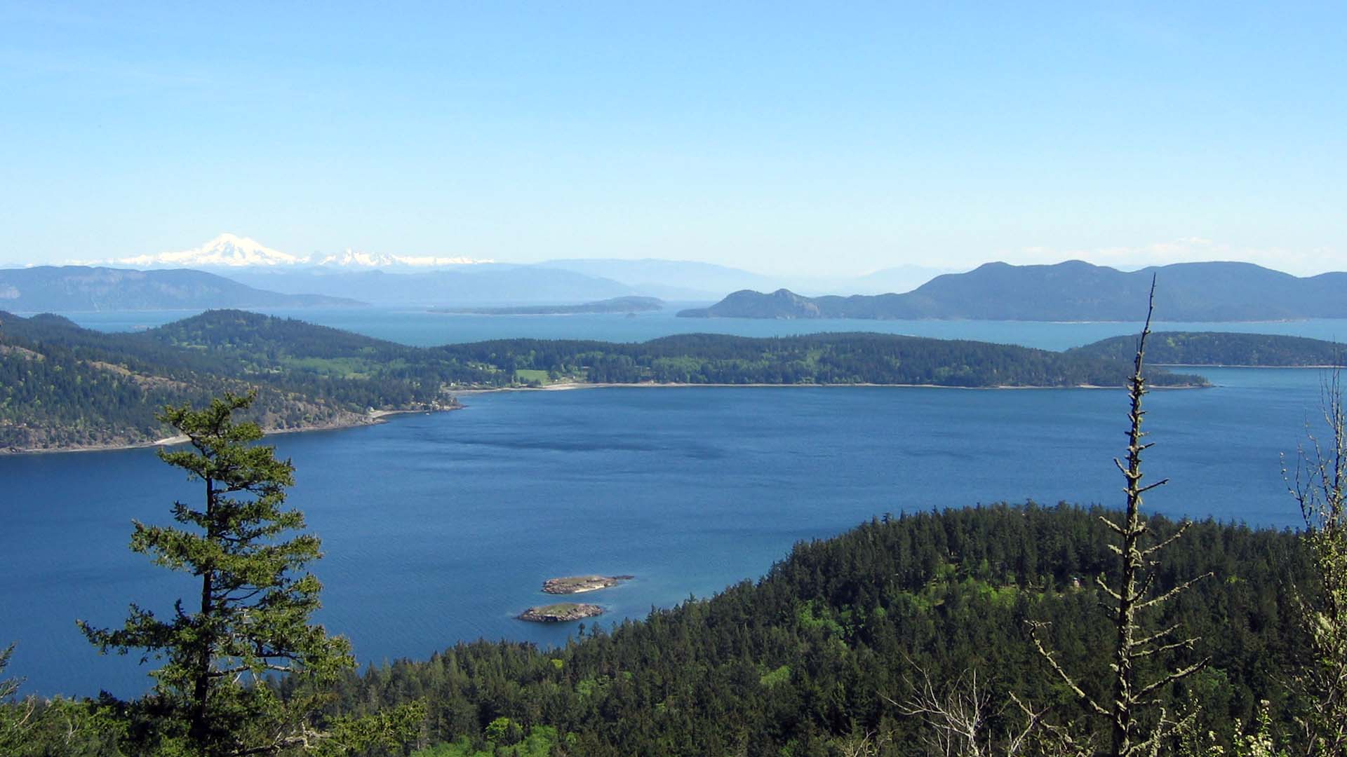
San Juan Island includes the Town of Friday Harbor, the governmental center of the county. Outside of town the landscapes give ways to open fields, forested hillsides, expansive views.
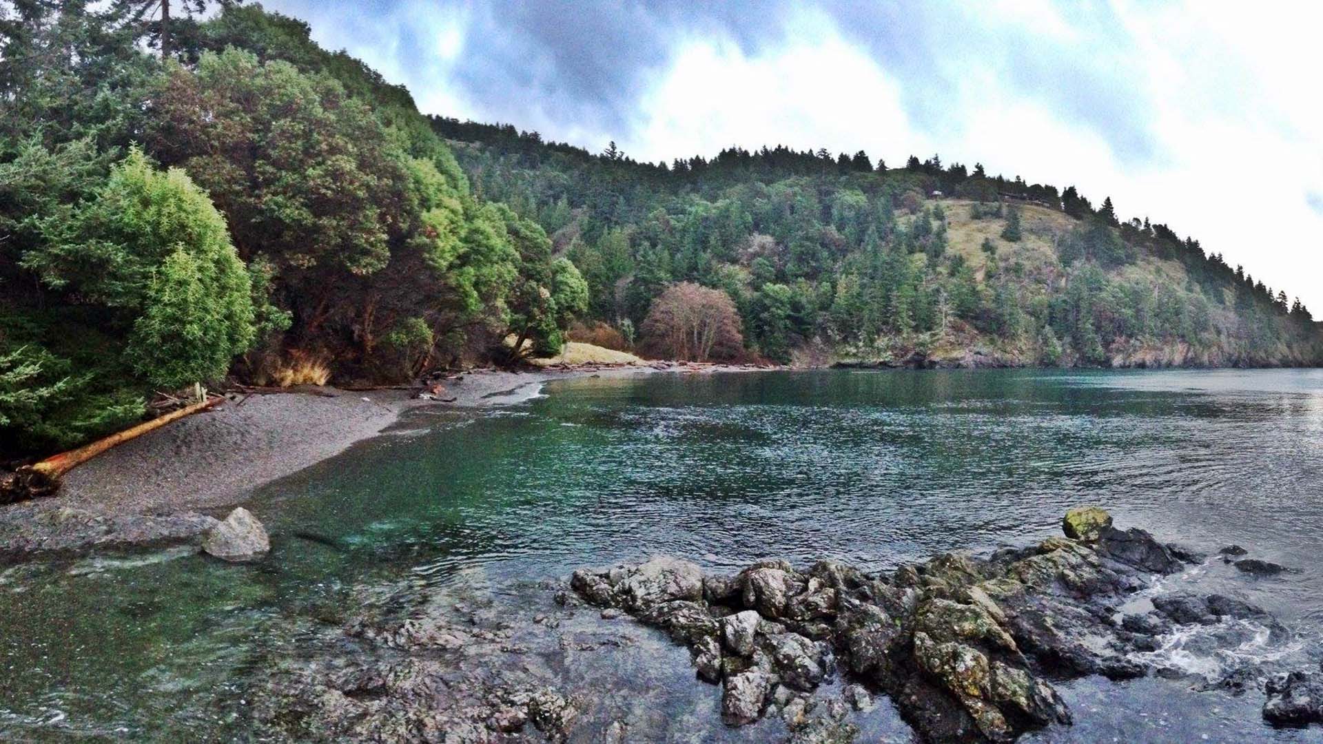
DEADMAN BAY PRESERVE
SAN JUAN ISLANDS
Preserves and
Conservation Easements
In this interactive map, you can navigate through your protected lands in San Juan County. Click on the pins in this map and you will be directed to the respective Island with the island information and link to the listing of protected lands. Click "Back to County Map" to get back to the main selector.
Download Map (PDF) Here
San Juan County Land Bank
San Juan Island includes the Town of Friday Harbor, the governmental center of the county. Outside of town the landscapes give ways to open fields, forested hillsides, expansive views.
DEADMAN BAY PRESERVE