
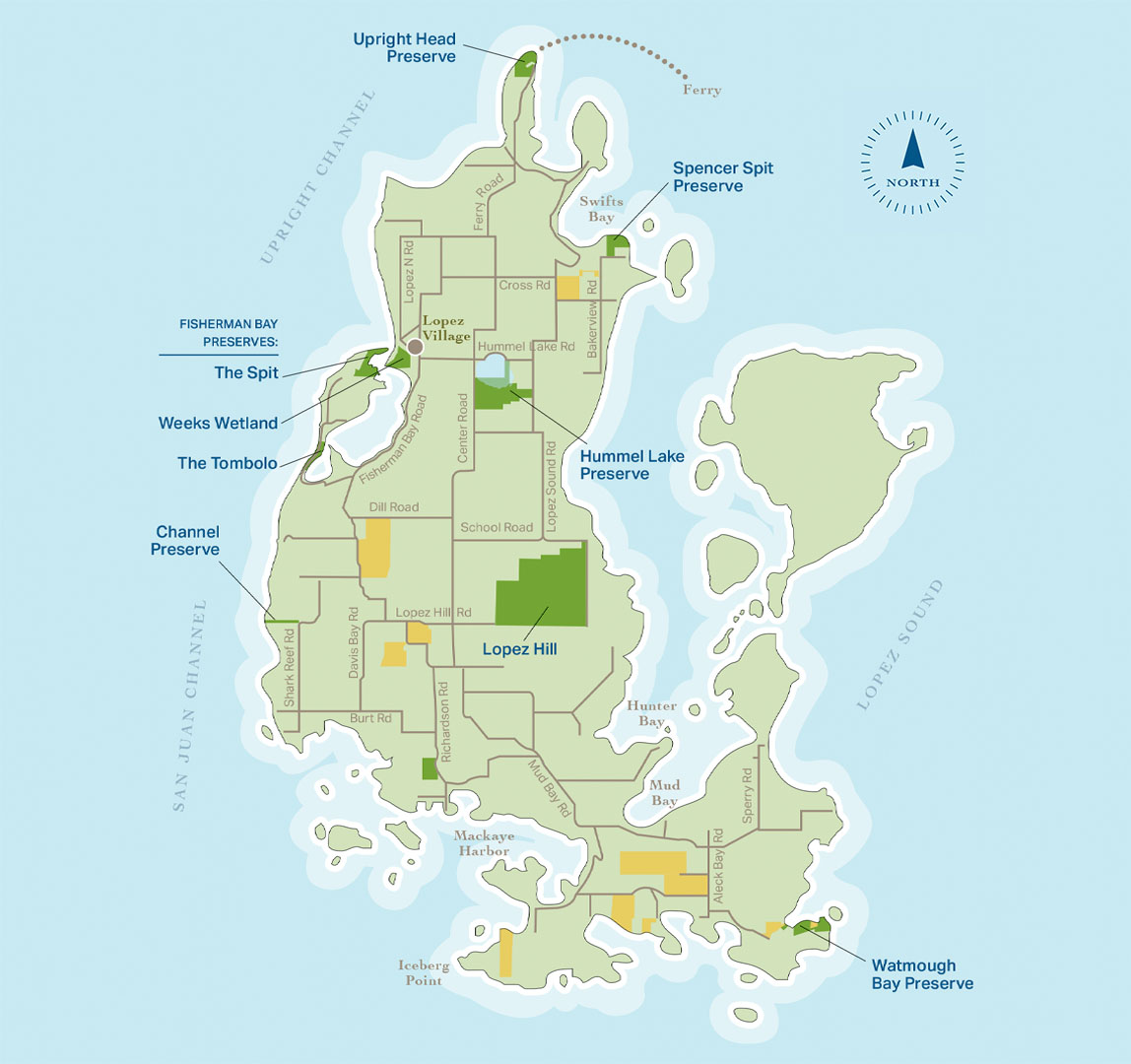
Lopez Island
Lopez Island includes a large fertile valley, gentle topography and generous coves and bays
Click pins to view land details.
OPEN TO THE PUBLIC
CLOSED TO PUBLIC ACCESS


Download Map (PDF) Here
FISHERMAN BAY PRESERVES THE SPIT
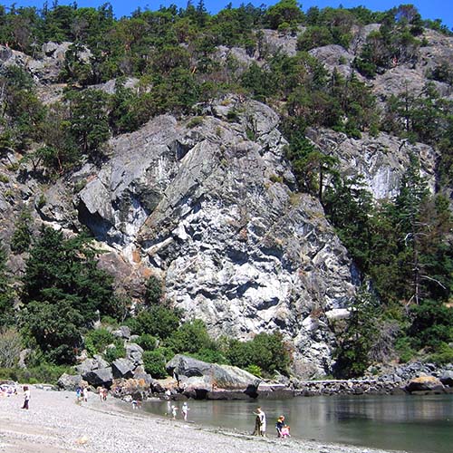
The Spit: This 29-acre property includes open meadows, woodlands, wetlands, approximately 1 mile of shoreline and an exquisite sandy spit marking the entrance to Fisherman Bay. The scenic setting is visible from numerous locations and travel ways, including Lopez Village, San Juan Channel and Fisherman Bay. The public has enjoyed traditional access to the property for many years. Community residents value this property for its recreational opportunities and unique landscape. The property contains important ecological and cultural resources.
OPEN TO THE PUBLIC
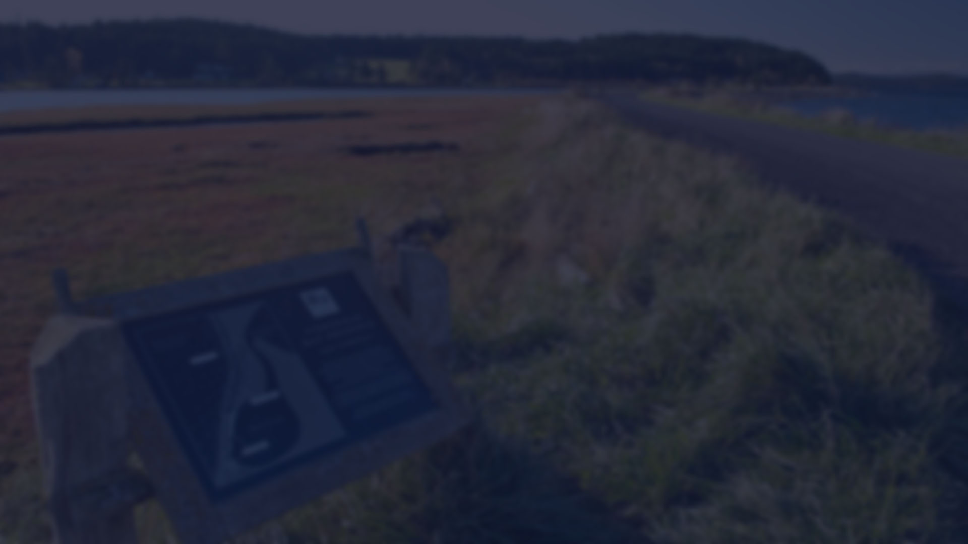
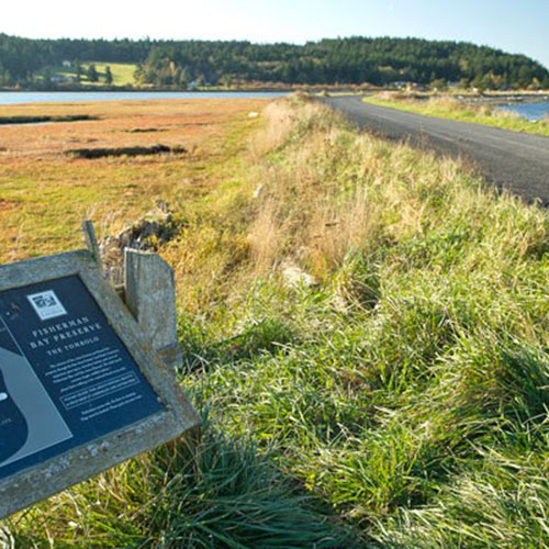
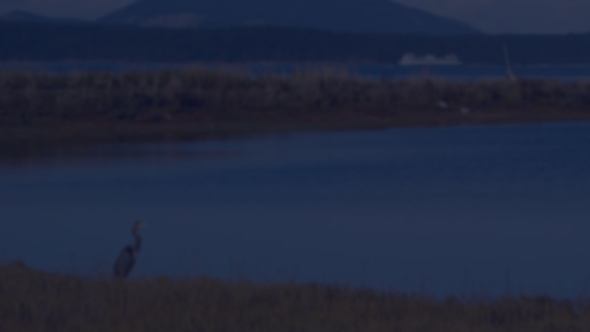
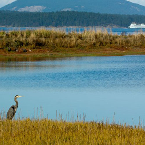
FISHERMAN BAY PRESERVES THE TOMBOLO
The Tombolo: This long, low tombolo was acquired for its extraordinary ecological, scenic and public access values. This natural geologic feature (connecting an island to another island) acts as a buffer between San Juan Channel and Fisherman Bay. The tombolo and its surrounding tidal flats and shoreline provide habitat for numerous wildlife, waterfowl and marine organisms.
OPEN TO THE PUBLIC
FISHERMAN BAY PRESERVES WEEKS WETLANDS
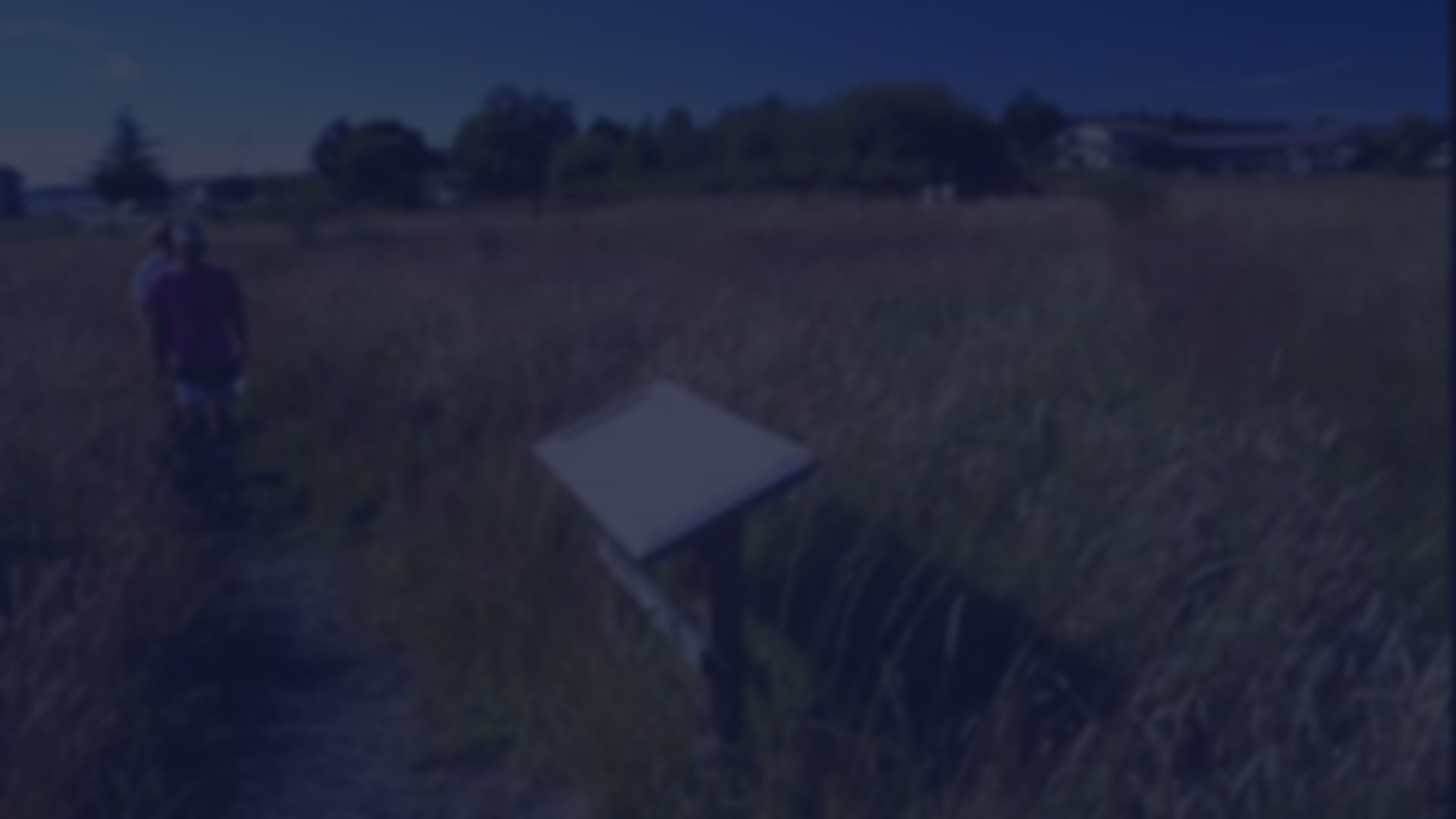
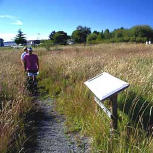
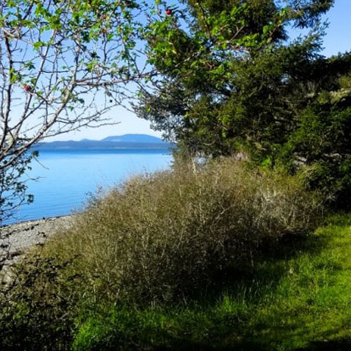
Weeks Wetland: The 24-acre Weeks Wetland property with its unique saltwater wetland is adjacent to Lopez Village on Fisherman Bay. A rustic trail provides access to an observation deck overlooking the wetland. Visitors may discover the abundance of migratory birds and wetland plants, learn about life in the wetlands from interpretive signs, and watch boats enter and exit Fisherman Bay. Weeks Wetland was funded in-part by a matching grant from the State Department of Natural Resources.
OPEN TO THE PUBLIC

HUMMEL LAKE PRESERVE
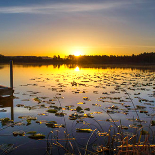
Located on the south end of Lopez Island’s largest freshwater lake, this 80-acre Preserve includes 1,450 feet of lakefront shoreline, wetland, meadow, forest, and habitat for many bird species. A trail disappears into a small cedar grove, meanders through the forest, and continues along the edge between the forest and meadow eventually winding up at the floating dock. A longer hiking trail starts at the parking lot and wanders through the forest to Port Stanley Road.
OPEN TO THE PUBLIC
LOPEZ HILL PRESERVE
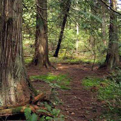
Lopez Hill encompasses 399 acres, including the highest point on the island. The property is notable for its expanse of mature second-growth forest, diverse freshwater wetlands, and scattered rocky meadows. Originally owned by the Washington State Department of Natural Resources, the Land Bank negotiated a 50-year lease in 2009 to manage the property for its ecological and recreational values. In 2018, the Land Bank purchased the property outright. Over four miles of primitive trails are open to pedestrians, equestrians, and mountain bikers. Limited deer hunting is also permitted; for current regulations please visit our Hunting Access Information webpage. The Friends of Lopez Hill built and helps maintain the trails on the property. A detailed trail map is available from their website.
OPEN TO THE PUBLIC
UPRIGHT HEAD PRESERVE
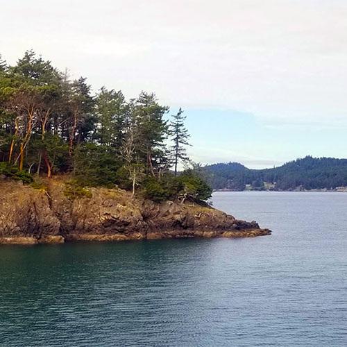
Upright Head is the northernmost point on Lopez Island and is an important landmark recognized by many who travel the state ferry system. This 26-acre property includes 2,023 feet of medium and high-bank waterfront on Harney and Upright Channels. It lies adjacent to the Lopez ferry landing and surrounds a 2-acre lot owned by the Washington State Department of Transportation. As the property possesses development infrastructure including water system and road for a 13-lot subdivision, residential development on the property would be highly visible from the water. Protecting this land prevents development and secures otter habitat, old growth forest, and interesting geological features.
OPEN TO THE PUBLIC
WATMOUGH BAY PRESERVE
Dramatic cliffs and towering old growth Douglas firs frame the stunning Watmough Bay Preserve at the south end of Lopez Island. In 1993, a seventy-foot section of beach was generously donated to the Land Bank in order to ensure public access to this local treasure. A conservation easement added onto the adjacent 8-acre fresh water wetland helps to further protect the area’s fragile ecosystem and prevents development of the adjacent uplands. The Bureau of Land Management purchased the surrounding 390 acres and has designated the property as an Area of Critical Environmental Concern. In 2007, the Land Bank partnered with the San Juan Preservation Trust to protect an additional 7.29 acres with approximately 680 feet of high bank waterfront along the south side of the bay. A neighboring property owner generously gifted two parcels in an effort to conserve the character of the bay, protect significant ecological features, and maintain the public access that we enjoy.
OPEN TO THE PUBLIC
CHANNEL PRESERVE
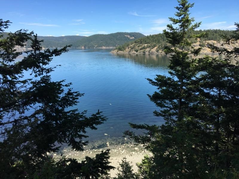
In June 2017, the Land Bank purchased roughly 9.5 acres on the west side of Lopez Island. These shoreline parcels fronting San Juan Channel have a walking trail through the forest, roughly 465 feet of public sandy beach, and at low tides, connect to over one mile of public tidelands. This purchase would not have been possible without the combined efforts of the Land Bank, donations from the Lopez community, and grants from the Recreation and Conservation Office. Public access is limited to daylight hours only. At high tides, public tidelands below mean high water are submerged and access is limited to the Land Bank uplands and beachfront. To protect nearshore wildlife, dogs are not allowed.
OPEN TO THE PUBLIC
SPENCER SPIT PRESERVE
Large western red cedars define the forested area of the property, with a high bank bluff running the entire length of the shoreline. This kind of “feeder” bluff provides important nutrients to the nearshore area and its abundant eel grass. From the trail, enjoy a peak-a-boo opening with a view of Flower Island and Blakely Island. We appreciate our partners, Washington State Parks, who will manage the property and who hosts the trailhead and parking for Spencer Spit Preserve visitors.
OPEN TO THE PUBLIC
Lopez Island
Lopez Island includes a large fertile valley, gentle topography and generous coves and bays
Click pins to view land details.
OPEN TO THE PUBLIC
CLOSED TO PUBLIC ACCESS
Download Map (PDF) Here
FISHERMAN BAY PRESERVES THE SPIT
The Spit: This 29-acre property includes open meadows, woodlands, wetlands, approximately 1 mile of shoreline and an exquisite sandy spit marking the entrance to Fisherman Bay. The scenic setting is visible from numerous locations and travel ways, including Lopez Village, San Juan Channel and Fisherman Bay. The public has enjoyed traditional access to the property for many years. Community residents value this property for its recreational opportunities and unique landscape. The property contains important ecological and cultural resources.
OPEN TO THE PUBLIC
FISHERMAN BAY PRESERVES THE TOMBOLO
The Tombolo: This long, low tombolo was acquired for its extraordinary ecological, scenic and public access values. This natural geologic feature (connecting an island to another island) acts as a buffer between San Juan Channel and Fisherman Bay. The tombolo and its surrounding tidal flats and shoreline provide habitat for numerous wildlife, waterfowl and marine organisms.
OPEN TO THE PUBLIC
FISHERMAN BAY PRESERVES WEEKS WETLANDS
Weeks Wetland: The 24-acre Weeks Wetland property with its unique saltwater wetland is adjacent to Lopez Village on Fisherman Bay. A rustic trail provides access to an observation deck overlooking the wetland. Visitors may discover the abundance of migratory birds and wetland plants, learn about life in the wetlands from interpretive signs, and watch boats enter and exit Fisherman Bay. Weeks Wetland was funded in-part by a matching grant from the State Department of Natural Resources.
OPEN TO THE PUBLIC
HUMMEL LAKE PRESERVE
Located on the south end of Lopez Island’s largest freshwater lake, this 80-acre Preserve includes 1,450 feet of lakefront shoreline, wetland, meadow, forest, and habitat for many bird species. A trail disappears into a small cedar grove, meanders through the forest, and continues along the edge between the forest and meadow eventually winding up at the floating dock. A longer hiking trail starts at the parking lot and wanders through the forest to Port Stanley Road.
OPEN TO THE PUBLIC
LOPEZ HILL PRESERVE
Lopez Hill encompasses 399 acres, including the highest point on the island. The property is notable for its expanse of mature second-growth forest, diverse freshwater wetlands, and scattered rocky meadows. Originally owned by the Washington State Department of Natural Resources, the Land Bank negotiated a 50-year lease in 2009 to manage the property for its ecological and recreational values. In 2018, the Land Bank purchased the property outright. Over four miles of primitive trails are open to pedestrians, equestrians, and mountain bikers. Limited deer hunting is also permitted; for current regulations please visit our Hunting Access Information webpage. The Friends of Lopez Hill built and helps maintain the trails on the property. A detailed trail map is available from their website.
OPEN TO THE PUBLIC
UPRIGHT HEAD PRESERVE
Upright Head is the northernmost point on Lopez Island and is an important landmark recognized by many who travel the state ferry system. This 26-acre property includes 2,023 feet of medium and high-bank waterfront on Harney and Upright Channels. It lies adjacent to the Lopez ferry landing and surrounds a 2-acre lot owned by the Washington State Department of Transportation. As the property possesses development infrastructure including water system and road for a 13-lot subdivision, residential development on the property would be highly visible from the water. Protecting this land prevents development and secures otter habitat, old growth forest, and interesting geological features.
OPEN TO THE PUBLIC
WATMOUGH BAY PRESERVE
Dramatic cliffs and towering old growth Douglas firs frame the stunning Watmough Bay Preserve at the south end of Lopez Island. In 1993, a seventy-foot section of beach was generously donated to the Land Bank in order to ensure public access to this local treasure. A conservation easement added onto the adjacent 8-acre fresh water wetland helps to further protect the area’s fragile ecosystem and prevents development of the adjacent uplands. The Bureau of Land Management purchased the surrounding 390 acres and has designated the property as an Area of Critical Environmental Concern. In 2007, the Land Bank partnered with the San Juan Preservation Trust to protect an additional 7.29 acres with approximately 680 feet of high bank waterfront along the south side of the bay. A neighboring property owner generously gifted two parcels in an effort to conserve the character of the bay, protect significant ecological features, and maintain the public access that we enjoy.
OPEN TO THE PUBLIC
CHANNEL PRESERVE
In June 2017, the Land Bank purchased roughly 9.5 acres on the west side of Lopez Island. These shoreline parcels fronting San Juan Channel have a walking trail through the forest, roughly 465 feet of public sandy beach, and at low tides, connect to over one mile of public tidelands. This purchase would not have been possible without the combined efforts of the Land Bank, donations from the Lopez community, and grants from the Recreation and Conservation Office. Public access is limited to daylight hours only. At high tides, public tidelands below mean high water are submerged and access is limited to the Land Bank uplands and beachfront. To protect nearshore wildlife, dogs are not allowed.
OPEN TO THE PUBLIC
SPENCER SPIT PRESERVE
Large western red cedars define the forested area of the property, with a high bank bluff running the entire length of the shoreline. This kind of “feeder” bluff provides important nutrients to the nearshore area and its abundant eel grass. From the trail, enjoy a peak-a-boo opening with a view of Flower Island and Blakely Island. We appreciate our partners, Washington State Parks, who will manage the property and who hosts the trailhead and parking for Spencer Spit Preserve visitors.
OPEN TO THE PUBLIC