
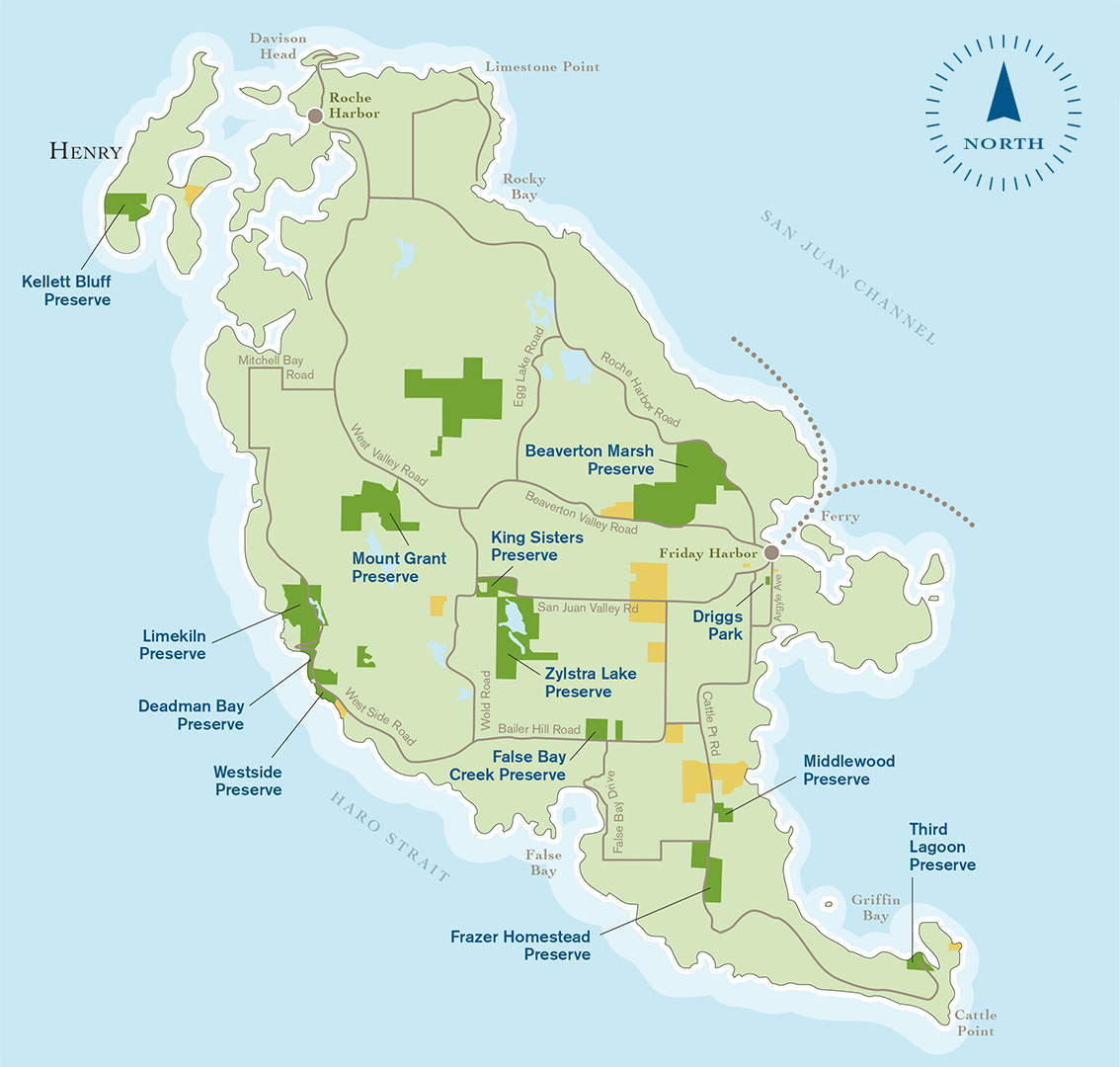
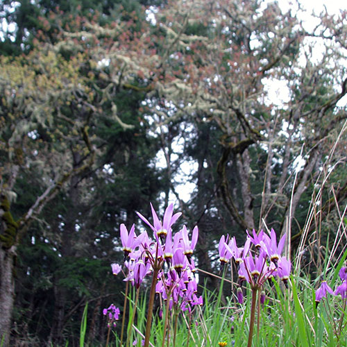
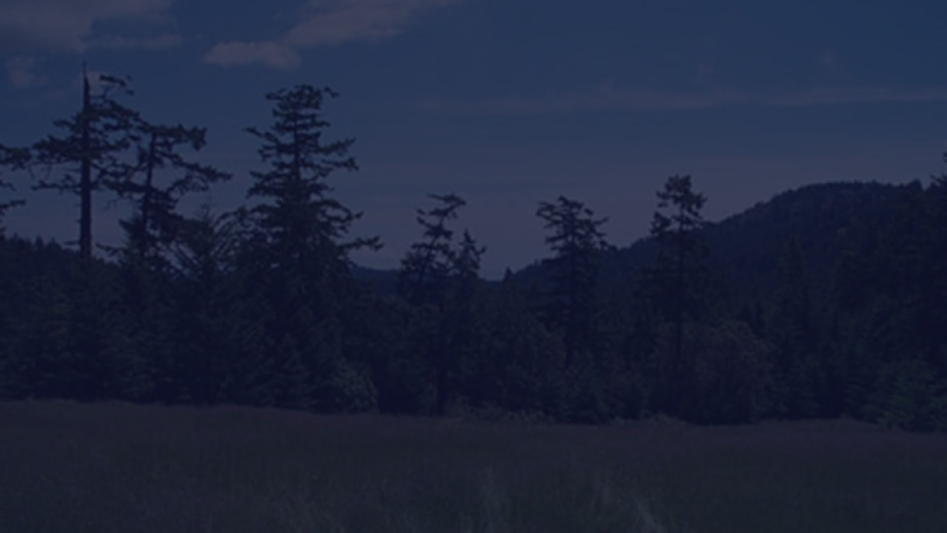
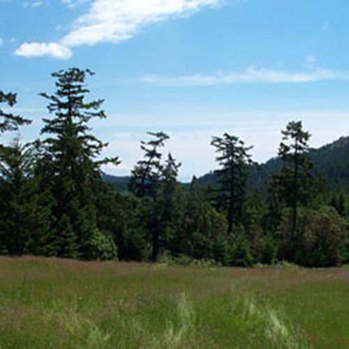
San Juan Island
San Juan Island includes the Town of Friday Harbor, the governmental center of the county. Outside of the town the landscape gives ways to open fields, forested hillside and expansive views.
Click pins to view land details.
OPEN TO THE PUBLIC
CLOSED TO PUBLIC ACCESS


Download Map (PDF) Here
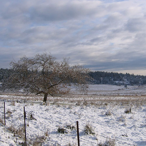
DEADMAN BAY PRESERVE
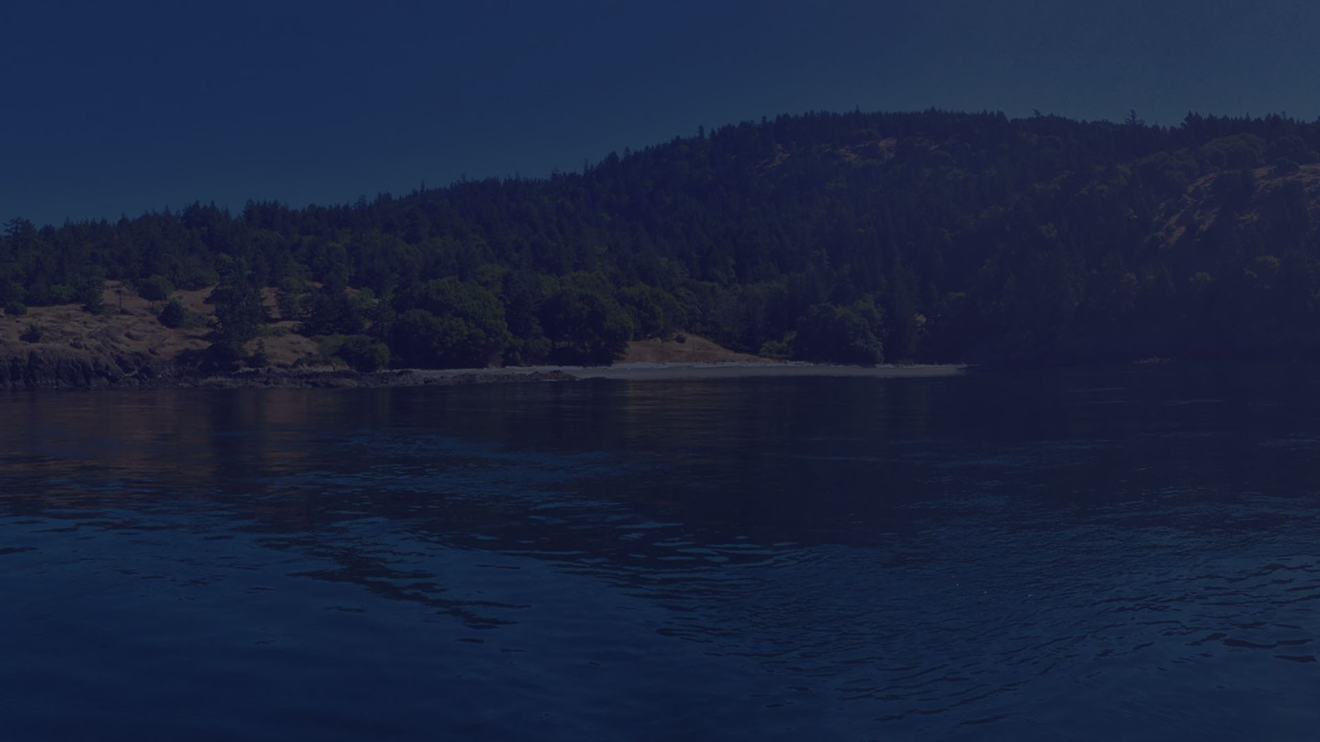
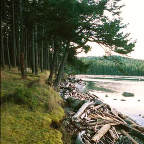
This public land on the west side of San Juan Island provides access to 1,600 feet of shoreline just south of Limekiln Point State Park. Visitors may walk along the gravel beach and watch for whales and other marine life from the shore overlooking Haro Strait. Here are panoramic views across Puget Sound to Vancouver Island, the Olympic Mountains, north to Limekiln State Park, and beyond. The Land Bank received a grant from the Washington State Interagency Committee to make the completion of this project possible.
ACCESSIBLE TO THE PUBLIC
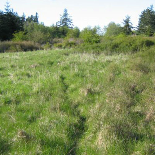
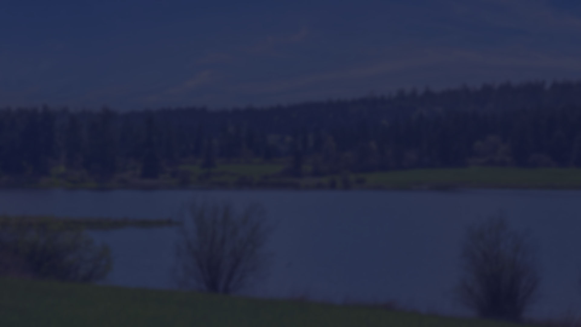
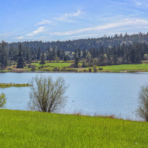
LIMEKILN PRESERVE AND WESTSIDE LAKE
The Land Bank acquired this land for its ecological, scenic, and public access values. This 174-acre preserve abuts Deadman Bay, surrounds Limekiln Point State Park to the east, and stretches north along Westside Road. A dam impounds Westside Lake and controls the outflow of drainage into Deadman Bay. When the Land Bank purchased the Limekiln Preserve in 1997, it acquired approximately two-thirds of Westside Lake. Protection of the remainder of the lake and the drainage into Deadman Bay had been a priority for the Land Bank Commission. The acquisition of the remainder of the ten-acre Westside Lake property three years later secured complete protection of the lake providing additional recreational access as well as habitat for waterfowl, other birds, and wildlife.
ACCESSIBLE TO THE PUBLIC
THIRD LAGOON PRESERVE
Adjacent to American Camp National Historic Park and the Cattle Point Natural Resources Conservation Area, these 20 acres include a rare saltwater lagoon of national, state, and local significance; a low vegetated berm; a sandy inter-tidal salt marsh; and a mature Douglas Fir upland forest. The lagoon and its surroundings provide habitat for numerous wildlife and marine organisms including nesting bald eagles and a great blue heron rookery. During winter, migrating waterfowl frequent the preserve. Acquired in partnership with the Washington State Department of Natural Resources, a legally-binding agreement between the Department of Natural Resources and the Land Bank ensures preservation in perpetuity of this important habitat.
ACCESSIBLE TO THE PUBLIC
WESTSIDE PRESERVE
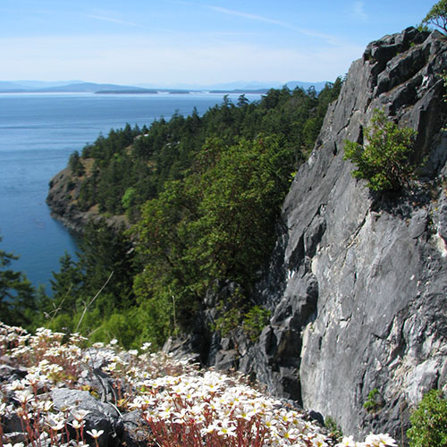
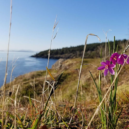
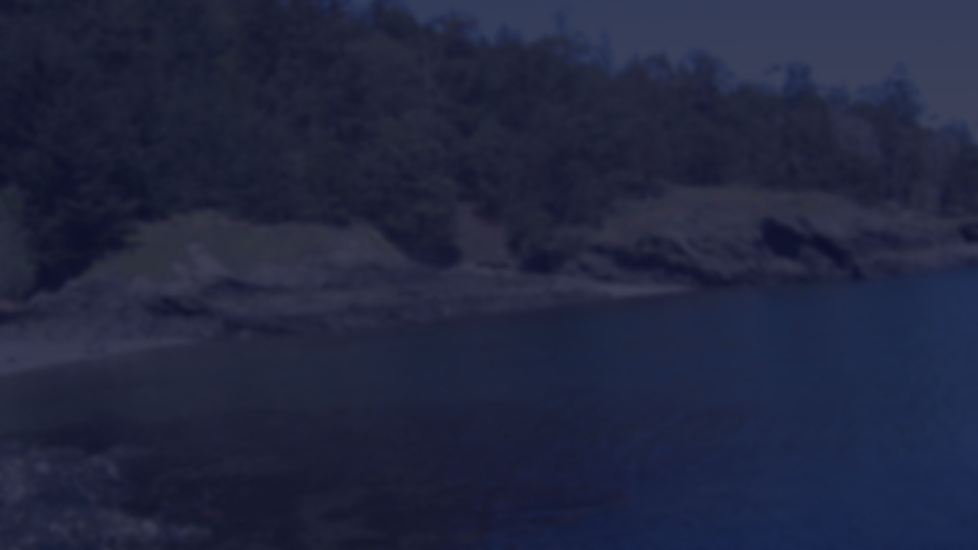
This open expanse lying west of Westside Road provides public access to nearly 16 acres and protects over one-half mile of shoreline south of the Land Bank’s Deadman Bay Preserve. Most notable among this land’s features is the biologically-rich, rocky, inter-tidal habitat and offshore reef. The property offers spectacular panoramic views and visitors may watch for whales and other marine life from the high rocky bluffs that overlook Haro Strait. While best known for its scenic attributes, the Westside Preserve also has ecological significance as a remnant of an ancient prairie ecosystem. Maintaining and restoring native prairie is one of the Land Bank’s goals here.
ACCESSIBLE TO THE PUBLIC

KING SISTERS PRESERVE
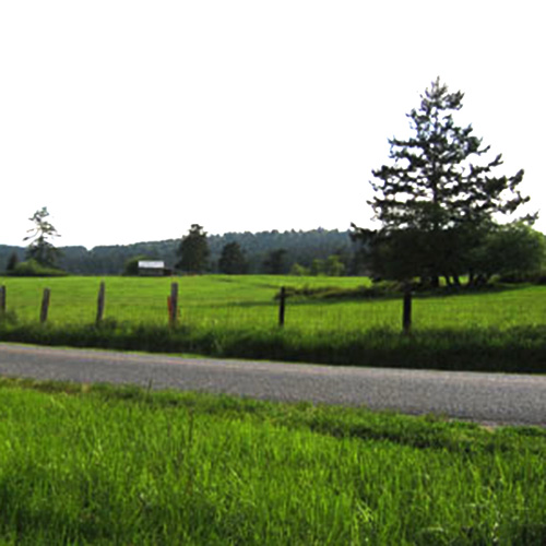
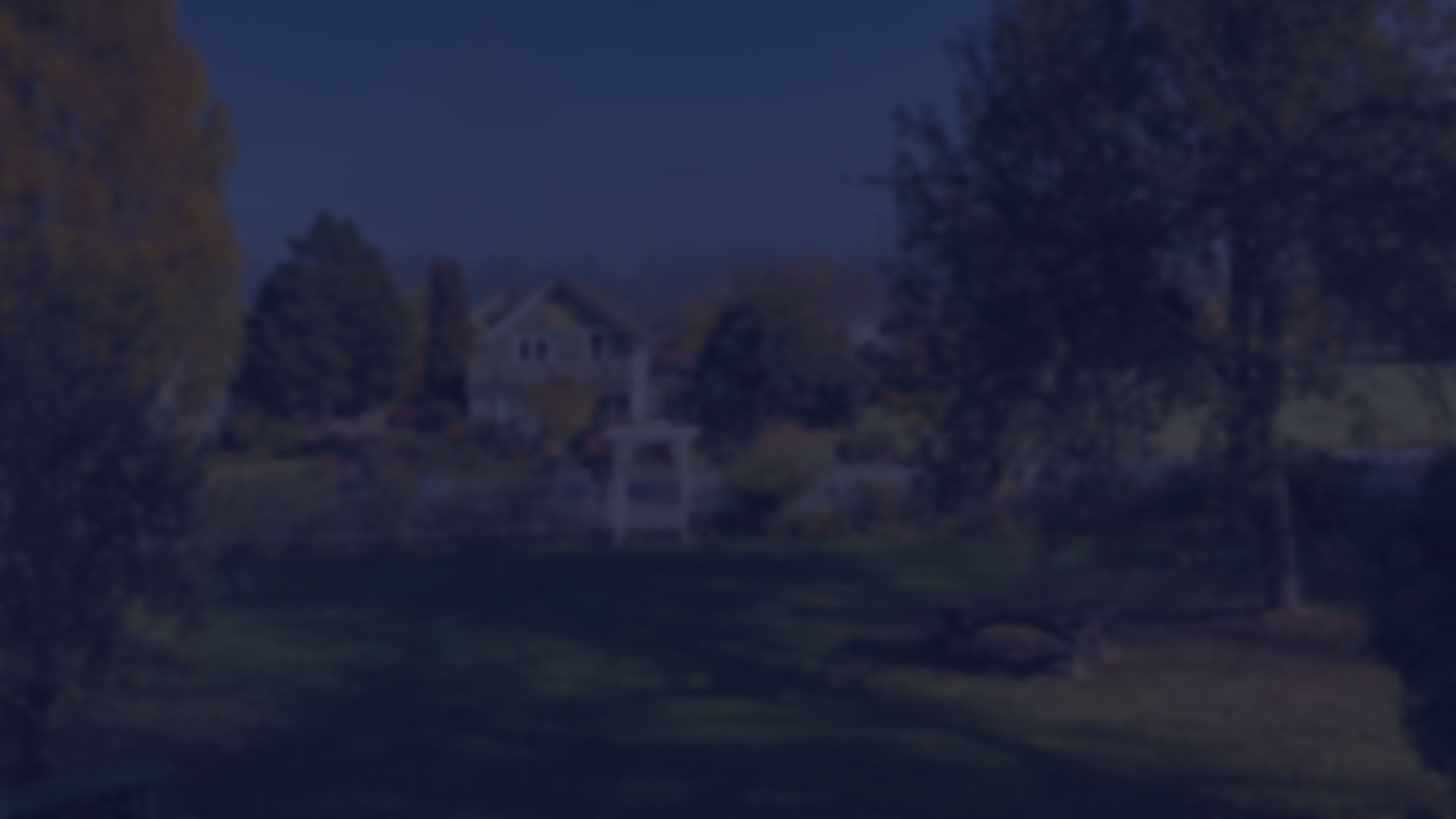
The King Sisters Preserve is located at the heart of San Juan Island, protecting fertile farmland, scenic views, forest, and a stream corridor. Owned by the King family since the 1930s, the Land Bank and the four King sisters put together a plan to protect the land: some acreage remained in family hands while the 62-acre majority was purchased by the Land Bank. A public walking trail parallels San Juan Valley Road. It provides views of the valley, Mt. Dallas, and agricultural operations on the preserve. The bulk of the property is now leased to local farmers, and the land continues its traditional role in local agriculture.
ACCESSIBLE TO THE PUBLIC
MOUNT GRANT PERSERVE
OPEN TO THE PUBLIC
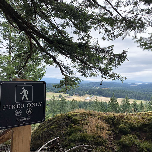
Located between Mount Dallas and Cady Mountain on San Juan Island, Mount Grant Preserve protects and provides access to 250 acres of diverse forest, woodlands, and meadows. Visitors to the ridgetop summit are rewarded with sweeping vistas in all directions. Trails and roadways to the summit are open daily for pedestrian and non-motorized use. Driving access to the summit is open Sundays, weather permitting, from 10am to 7pm, (April – September) and 10am to 4pm, (October- March), for everyone to enjoy the Preserve’s expansive views, regardless of physical ability.

BEAVERTON MARSH PRESERVE
OPEN TO THE PUBLIC
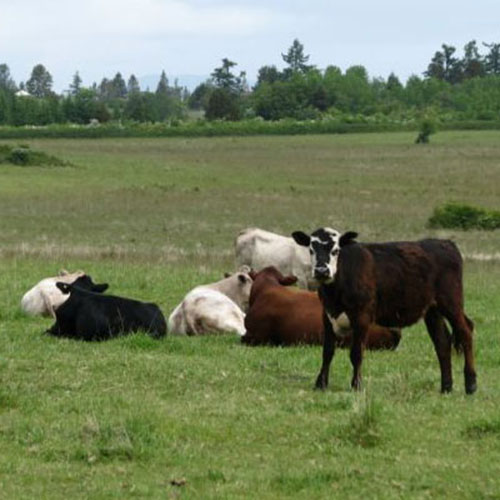
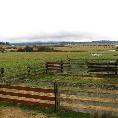
Grazing cattle, rows of baled hay, open pasture, and family memories closely link this 128-acre homestead to the agricultural heritage of our islands. With nearly a mile of frontage on Roche Harbor Road, Beaverton Marsh has outstanding scenic value as one of the gateways into the Town of Friday Harbor. The property includes a significant portion of one of the most expansive wetland systems in the county. Subsequent to the initial 128-acre acquisition, 7 additional acres of wetland immediately adjacent were acquired. Wetlands provide vital hydraulic functions such as recharge, storage, and purification. Wetlands also attract and sustain numerous species of wildlife. Rare Eurasian widgeons and the more common American widgeon are spotted feeding here. Trumpeter swans, hooded mergansers, and bufflehead ducks also visit the wetland in winter. Public use begins once hay harvest is complete in approximately mid-July, and ends when fall rains saturate the fields, usually in October or later.
FRAZER HOMESTEAD PRESERVE
The 68-acre Frazer Homestead Preserve protects farmland and scenic views immediately adjacent to the American Camp unit of San Juan Island National Historic Park. The bulk of the preserve is leased for agricultural use to a local farmer. It is also the home of restoration efforts focused on increasing breeding grounds for the endangered Island Marble Butterfly through planting mustard plants. A trail of slightly over a mile connects the Frazer Homestead Preserve to the American Camp visitor center. It offers views across the farmland to old homesteads, distant islands, and Mount Baker preserving the beloved landscape we call home.
OPEN TO THE PUBLIC
CADY MOUNTAIN PRESERVE
130-acre Cady Mountain Preserve features outstanding views, rare Garry oak habitat, mature forest, and pocket grasslands. Stewardship activities have focused on maintaining and restoring the oaks and their associated habitats. A long-term aim for this preserve is to create primitive walking trails and eventually open it for public access.
CLOSED TO PUBLIC ACCESS
FALSE BAY CREEK PRESERVE
False Bay Creek is the largest watercourse on San Juan Island, and one with high potential to support native fish such as cutthroat trout or salmon. The agricultural use that adjoins the creek is another important aspect of this land. The Land Bank purchased these 39 acres of pasture along False Bay Creek at the intersection of Bailer Hill Road and False Bay Drive in 2008. A pre-existing conservation easement held by the San Juan Preservation Trust doubly serves to protect the land’s agricultural, open space, and habitat values by prohibiting structures.
OPEN TO PUBLIC ACCESS SEASONALLY
LOWER CATTLE POINT ROAD ANDERSON PROPERTY
These forty acres frame the gateway into the American Camp area of San Juan Island National Historical Park. It includes precious forest, meadow, and wetland. The Land Bank expects to include it in the Conservation Buyer Program ensuring protection of its scenic and natural values with a conservation easement.
CLOSED TO PUBLIC ACCESS
MOUNT BEN PRESERVE
Mount Ben Preserve is located on the south shoulder of Mount Dallas. It protects important scenic and ecological resources. The Land Bank and San Juan Preservation Trust have partnered on this project with a goal of providing opportunity for public access to enjoy the beauty and diversity of the Preserve. The lower reaches of the preserve include mixed forest with gnarled old growth trees while in the upper reaches contain diverse wildflowers and rare prairie and savannah habitat. Outstanding views from the Preserve include the pastoral landscape of San Juan Valley, the rugged shorelines of San Juan and Lopez Islands, and broad vistas across the expanse of Juan De Fuca and Haro Straits to the Olympic Peninsula and Vancouver Island. The Land Bank and the Preservation Trust first acquired a conservation easement on this property in 2004. The landowner later gifted their remaining interest in the property with the wish that its resources be conserved and made available to the people of San Juan County in perpetuity.
CLOSED TO PUBLIC ACCESS

ALDERMAN
The Land Bank purchased this land to further its goal to preserve farmland in San Juan Valley. This ten-acre parcel is located on the floor of the San Juan Valley fronting Bailer Hill Road. It is still in agricultural use and provides views north into the San Juan Valley and south to the Olympic Peninsula. This land may be resold in the future encumbered by a conservation easement to protect its agricultural and open space value.
CLOSED TO PUBLIC ACCESS
TROUT LAKE WATERSHED
This 40-acre parcel situated near the top of the town watershed and surrounded on three sides by Town of Friday Harbor land is key for watershed protection.
CLOSED TO PUBLIC ACCESS
ZYLSTRA LAKE PRESERVE
In late 2015, the Land Bank and the non-profit San Juan Preservation Trust purchased Zylstra Lake, a 285-acre tract in San Juan Valley. Long coveted because of its importance to the False Bay watershed, expansive fields and proximity to existing conserved farmlands, the organizations made a big leap of faith, closing with $2.7 million still owed to the seller. The work began to secure grant funding, both from the federal and state government sources for the purposes of conserving the wildlife and riparian areas and to provide a recreational opportunity to the County’s residents. The partnership was successful on both counts and paid off the debt a year early in 2017. As with Mount Grant Preserve on San Juan Island and Turtleback Mountain Preserve on Orcas Island, Zylstra will be owned and managed by the Land Bank, and the Preservation Trust will hold a conservation easement on it. San Juan County Land Bank recently updated its Interim Stewardship and Management Plan (SMP) for the Zylstra Lake Preserve on San Juan Island. This updated interim plan details the Preserve’s abundant wildlife and habitat areas provides a collaborative strategy for engaging with agricultural interests; and proposes opening approximately two miles of trail this winter, with an additional mile added in summer. The updated interim is designed to extend the interim period for two years.
ACCESSIBLE TO THE PUBLIC
DRIGGS PARK
This public park in the heart of Friday Harbor provides 0.15 acres of outdoor space for island residents and visitors to sit, eat lunch, or chat with friends. Driggs Park is located on the corner of Caines Street and Argyle Ave, just a short walk from Spring Street. The Land Bank office is located directly adjacent to Driggs Park and occupies the historic Driggs house. The Driggs house was built around 1895 and was inhabited by G.B Driggs and his family. This historic property looked down upon the Driggs’ orchard and strawberry fields. It is possible that the apple tree and pear tree currently in Driggs Park could have been part of the Driggs’ original orchard. The Driggs house has been largely unchanged and maintains many of the original features.
Open to the Public
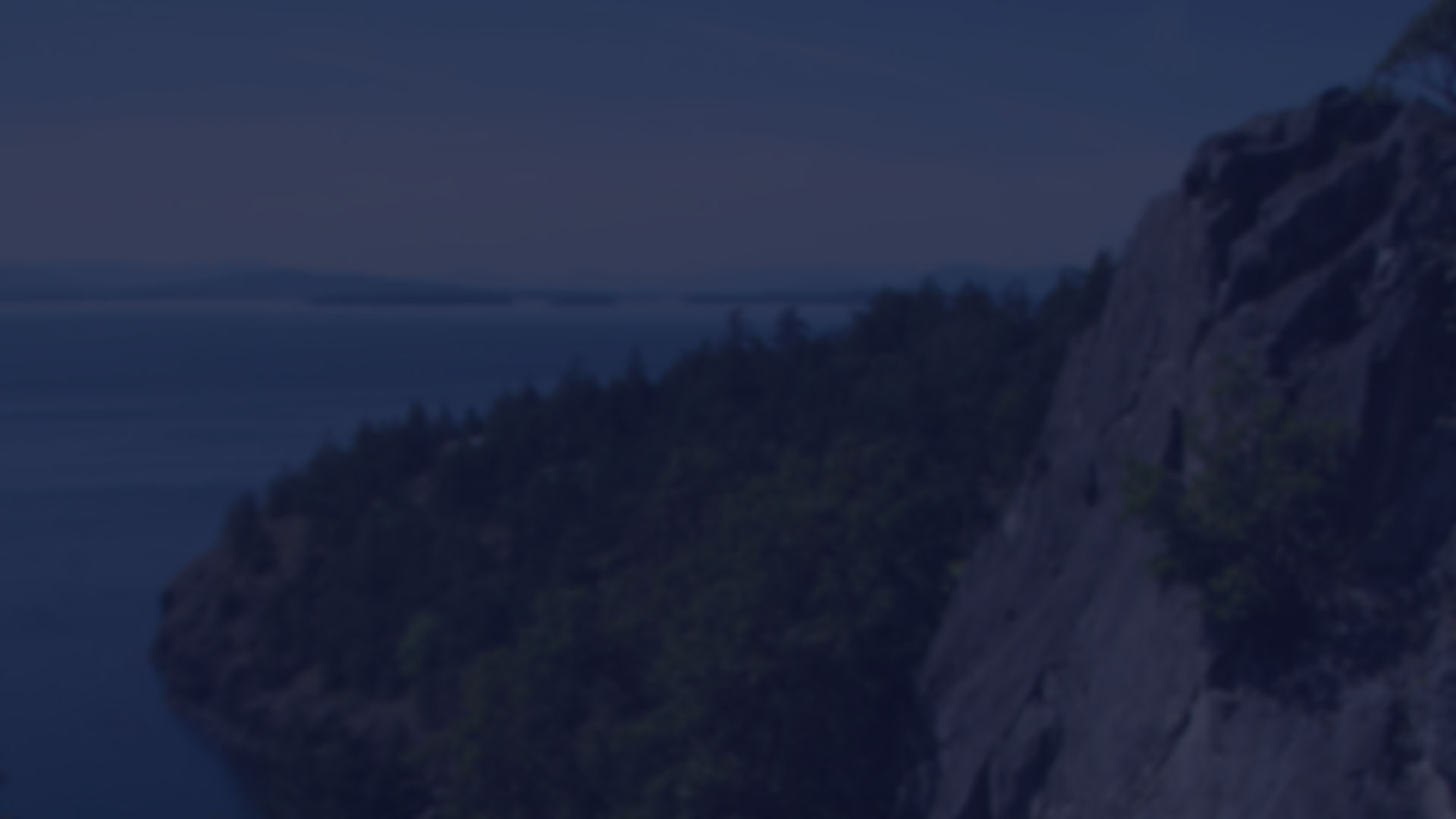
KELLET BLUFF PRESERVE
At the end of 2016, the Land Bank received the spectacular gift of Kellet Bluff Preserve, an 80-acre property on Henry Island, which has two shorelines extending over 3,100 feet in total. The western shore on the Haro Strait hosts cormorant rookeries, and above, Garry oak savannah reaches to the summit with expansive views to Vancouver Island. On the east, dense forests of the interior yield to Open Bay with several pocket beaches nestled amidst rocky outcrops. Note: There are no public docks or landing facilities at the Preserve. Access is by private boat, kayak, or other human-powered craft only. No overnight camping or fires of any kind are permitted. No motorized vessels are permitted on the beach.
Open to the Public with Conditions
San Juan Island
San Juan Island includes the Town of Friday Harbor, the governmental center of the county. Outside of the town the landscape gives ways to open fields, forested hillside and expansive views.
Click pins to view land details.
OPEN TO THE PUBLIC
CLOSED TO PUBLIC ACCESS
Download Map (PDF) Here
DEADMAN BAY PRESERVE
This public land on the west side of San Juan Island provides access to 1,600 feet of shoreline just south of Limekiln Point State Park. Visitors may walk along the gravel beach and watch for whales and other marine life from the shore overlooking Haro Strait. Here are panoramic views across Puget Sound to Vancouver Island, the Olympic Mountains, north to Limekiln State Park, and beyond. The Land Bank received a grant from the Washington State Interagency Committee to make the completion of this project possible.
OPEN TO THE PUBLIC
LIMEKILN PRESERVE AND WESTSIDE LAKE
The Land Bank acquired this land for its ecological, scenic, and public access values. This 174-acre preserve abuts Deadman Bay, surrounds Limekiln Point State Park to the east, and stretches north along Westside Road. A dam impounds Westside Lake and controls the outflow of drainage into Deadman Bay. When the Land Bank purchased the Limekiln Preserve in 1997, it acquired approximately two-thirds of Westside Lake. Protection of the remainder of the lake and the drainage into Deadman Bay had been a priority for the Land Bank Commission. The acquisition of the remainder of the ten-acre Westside Lake property three years later secured complete protection of the lake providing additional recreational access as well as habitat for waterfowl, other birds, and wildlife.
OPEN TO THE PUBLIC
THIRD LAGOON PRESERVE
Adjacent to American Camp National Historic Park and the Cattle Point Natural Resources Conservation Area, these 20 acres include a rare saltwater lagoon of national, state, and local significance; a low vegetated berm; a sandy inter-tidal salt marsh; and a mature Douglas Fir upland forest. The lagoon and its surroundings provide habitat for numerous wildlife and marine organisms including nesting bald eagles and a great blue heron rookery. During winter, migrating waterfowl frequent the preserve. Acquired in partnership with the Washington State Department of Natural Resources, a legally-binding agreement between the Department of Natural Resources and the Land Bank ensures preservation in perpetuity of this important habitat.
OPEN TO THE PUBLIC
WESTSIDE PRESERVE
This open expanse lying west of Westside Road provides public access to nearly 16 acres and protects over one-half mile of shoreline south of the Land Bank’s Deadman Bay Preserve. Most notable among this land’s features is the biologically-rich, rocky, inter-tidal habitat and offshore reef. The property offers spectacular panoramic views and visitors may watch for whales and other marine life from the high rocky bluffs that overlook Haro Strait. While best known for its scenic attributes, the Westside Preserve also has ecological significance as a remnant of an ancient prairie ecosystem. Maintaining and restoring native prairie is one of the Land Bank’s goals here.
OPEN TO THE PUBLIC
KING SISTERS PRESERVE
The King Sisters Preserve is located at the heart of San Juan Island, protecting fertile farmland, scenic views, forest, and a stream corridor. Owned by the King family since the 1930s, the Land Bank and the four King sisters put together a plan to protect the land: some acreage remained in family hands while the 62-acre majority was purchased by the Land Bank. A public walking trail parallels San Juan Valley Road. It provides views of the valley, Mt. Dallas, and agricultural operations on the preserve. The bulk of the property is now leased to local farmers, and the land continues its traditional role in local agriculture.
OPEN TO THE PUBLIC
Mount Grant Preserve
Located between Mount Dallas and Cady Mountain on San Juan Island, Mount Grant Preserve protects and provides access to 250 acres of diverse forest, woodlands, and meadows. Visitors to the ridgetop summit are rewarded with sweeping vistas in all directions. Trails and roadways to the summit are open daily for pedestrian and non-motorized use. Driving access to the summit is open Sundays, weather permitting, from 10am to 7pm, (April – September) and 10am to 4pm, (October- March), for everyone to enjoy the Preserve’s expansive views, regardless of physical ability.
OPEN TO THE PUBLIC
BEAVERTON MARSH PRESERVE
OPEN TO THE PUBLIC
Grazing cattle, rows of baled hay, open pasture, and family memories closely link this 128-acre homestead to the agricultural heritage of our islands. With nearly a mile of frontage on Roche Harbor Road, Beaverton Marsh has outstanding scenic value as one of the gateways into the Town of Friday Harbor. The property includes a significant portion of one of the most expansive wetland systems in the county. Subsequent to the initial 128-acre acquisition, 7 additional acres of wetland immediately adjacent were acquired. Wetlands provide vital hydraulic functions such as recharge, storage, and purification. Wetlands also attract and sustain numerous species of wildlife. Rare Eurasian widgeons and the more common American widgeon are spotted feeding here. Trumpeter swans, hooded mergansers, and bufflehead ducks also visit the wetland in winter. Public use begins once hay harvest is complete in approximately mid-July, and ends when fall rains saturate the fields, usually in October or later.
FRAZER HOMESTEAD PRESERVE
The 68-acre Frazer Homestead Preserve protects farmland and scenic views immediately adjacent to the American Camp unit of San Juan Island National Historic Park. The bulk of the preserve is leased for agricultural use to a local farmer. It is also the home of restoration efforts focused on increasing breeding grounds for the endangered Island Marble Butterfly through planting mustard plants. A trail of slightly over a mile connects the Frazer Homestead Preserve to the American Camp visitor center. It offers views across the farmland to old homesteads, distant islands, and Mount Baker preserving the beloved landscape we call home.
OPEN TO THE PUBLIC
CADY MOUNTAIN PRESERVE
130-acre Cady Mountain Preserve features outstanding views, rare Garry oak habitat, mature forest, and pocket grasslands. Stewardship activities have focused on maintaining and restoring the oaks and their associated habitats. A long-term aim for this preserve is to create primitive walking trails and eventually open it for public access.
CLOSED TO PUBLIC ACCESS
FALSE BAY CREEK PRESERVE
False Bay Creek is the largest watercourse on San Juan Island, and one with high potential to support native fish such as cutthroat trout or salmon. The agricultural use that adjoins the creek is another important aspect of this land. The Land Bank purchased these 39 acres of pasture along False Bay Creek at the intersection of Bailer Hill Road and False Bay Drive in 2008. A pre-existing conservation easement held by the San Juan Preservation Trust doubly serves to protect the land’s agricultural, open space, and habitat values by prohibiting structures.
OPEN TO PUBLIC ACCESS SEASONALLY
LOWER CATTLE POINT ROAD ANDERSON PROPERTY
These forty acres frame the gateway into the American Camp area of San Juan Island National Historical Park. It includes precious forest, meadow, and wetland. The Land Bank expects to include it in the Conservation Buyer Program ensuring protection of its scenic and natural values with a conservation easement.
CLOSED TO PUBLIC ACCESS
MOUNT BEN PRESERVE
Mount Ben Preserve is located on the south shoulder of Mount Dallas. It protects important scenic and ecological resources. The Land Bank and San Juan Preservation Trust have partnered on this project with a goal of providing opportunity for public access to enjoy the beauty and diversity of the Preserve. The lower reaches of the preserve include mixed forest with gnarled old growth trees while in the upper reaches contain diverse wildflowers and rare prairie and savannah habitat. Outstanding views from the Preserve include the pastoral landscape of San Juan Valley, the rugged shorelines of San Juan and Lopez Islands, and broad vistas across the expanse of Juan De Fuca and Haro Straits to the Olympic Peninsula and Vancouver Island. The Land Bank and the Preservation Trust first acquired a conservation easement on this property in 2004. The landowner later gifted their remaining interest in the property with the wish that its resources be conserved and made available to the people of San Juan County in perpetuity.
CLOSED TO PUBLIC ACCESS
ALDERMAN
The Land Bank purchased this land to further its goal to preserve farmland in San Juan Valley. This ten-acre parcel is located on the floor of the San Juan Valley fronting Bailer Hill Road. It is still in agricultural use and provides views north into the San Juan Valley and south to the Olympic Peninsula. This land may be resold in the future encumbered by a conservation easement to protect its agricultural and open space value.
CLOSED TO PUBLIC ACCESS
TROUT LAKE WATERSHED
This 40-acre parcel situated near the top of the town watershed and surrounded on three sides by Town of Friday Harbor land is key for watershed protection.
CLOSED TO PUBLIC ACCESS
ZYLSTRA LAKE PRESERVE
In late 2015, the Land Bank and the non-profit San Juan Preservation Trust purchased Zylstra Lake, a 285-acre tract in San Juan Valley. Long coveted because of its importance to the False Bay watershed, expansive fields and proximity to existing conserved farmlands, the organizations made a big leap of faith, closing with $2.7 million still owed to the seller. The work began to secure grant funding, both from the federal and state government sources for the purposes of conserving the wildlife and riparian areas and to provide a recreational opportunity to the County’s residents. The partnership was successful on both counts and paid off the debt a year early in 2017. As with Mount Grant Preserve on San Juan Island and Turtleback Mountain Preserve on Orcas Island, Zylstra will be owned and managed by the Land Bank, and the Preservation Trust will hold a conservation easement on it. San Juan County Land Bank recently updated its Interim Stewardship and Management Plan (SMP) for the Zylstra Lake Preserve on San Juan Island. This updated interim plan details the Preserve’s abundant wildlife and habitat areas; provides a collaborative strategy for engaging with agricultural interests; and proposes opening approximately two miles of trail this winter, with an additional mile added in summer. The updated interim is designed to extend the interim period for two years.
OPEN TO THE PUBLIC
DRIGGS PARK
This public park in the heart of Friday Harbor provides 0.15 acres of outdoor space for island residents and visitors to sit, eat lunch, or chat with friends. Driggs Park is located on the corner of Caines Street and Argyle Ave, just a short walk from Spring Street. The Land Bank office is located directly adjacent to Driggs Park and occupies the historic Driggs house. The Driggs house was built around 1895 and was inhabited by G.B Driggs and his family. This historic property looked down upon the Driggs’ orchard and strawberry fields. It is possible that the apple tree and pear tree currently in Driggs Park could have been part of the Driggs’ original orchard. The Driggs house has been largely unchanged and maintains many of the original features.
Open to the Public
KELLET BLUFF PRESERVE
At the end of 2016, the Land Bank received the spectacular gift of Kellet Bluff Preserve, an 80-acre property on Henry Island, which has two shorelines extending over 3,100 feet in total. The western shore on the Haro Strait hosts cormorant rookeries, and above, Garry oak savannah reaches to the summit with expansive views to Vancouver Island. On the east, dense forests of the interior yield to Open Bay with several pocket beaches nestled amidst rocky outcrops. Note: There are no public docks or landing facilities at the Preserve. Access is by private boat, kayak, or other human-powered craft only. No overnight camping or fires of any kind are permitted. No motorized vessels are permitted on the beach.
Open to the Public with Conditions